
Hotel Tibet
Hotel Tibet, a family-run boutique hotel that have blended traditional Tibetan designs with a touch of modern simplicity.
Trekking and Hiking
Duration
22 Days TripMeals
22B,22L,21DStart Point
KathmanduEnd Point
KathmanduStyle
Guided TrekkingMax. Altitude
4,700m at Dudh KundaTrip Grade
Challenging to StrenousLodging
Teahouses (Mountain Lodges), Hotels in KathmanduRolwaling is a remote and rugged Himalayan valley in northeastern Nepal, situated within the Dolakha District along the border with Tibet. Known as a “Beyul,” or one of the seven sacred “hidden valleys” in Buddhist mythology, it is believed to have been blessed by Guru Rinpoche as a sanctuary for his followers. The region remains largely untouched by modern commercialization, offering a raw and authentic experience of high-altitude life that is distinct from more popular trekking hubs like Everest or Annapurna.
The landscape of Rolwaling is dominated by the majestic Gaurishankar (7,134 m), a dual-summit peak that holds deep religious significance for both Hindus and Buddhists, representing the deities Shiva and Parvati. At the heart of the valley lies Tsho Rolpa, one of Nepal’s largest glacial lakes, situated at an altitude of 4,580 meters. The valley’s geography is famously steep and narrow, leading to its local name, which translates to “the valley carved by a plough”.
The valley is primarily inhabited by the Sherpa and Tamang people, whose lifestyles are deeply tied to the land through yak herding and high-altitude farming. The village of Beding is renowned as the “home of the summiteers,” as nearly every household boasts a resident who has successfully scaled Mount Everest. Culturally, the region is a “no-kill zone,” where ancient spiritual laws prohibit the slaughter of animals, preserving a peaceful coexistence with local wildlife like snow leopards and red pandas. For adventurers, trekking in Rolwaling is a moderately strenuous endeavor that rewards visitors with unmatched solitude. The trail follows the Tamakoshi River and winds through lush rhododendron forests before ascending into the stark, alpine beauty of Na Gaon. More experienced mountaineers often continue beyond Tsho Rolpa to cross the challenging Tashi Lapcha Pass (5,755 m), which provides a high-altitude bridge into the Khumbu region of Everest.
Cultural & Spiritual Highlights
Adventurous Extensions
A Himalayan Chemi representative will collect you from the airport. It’s a free day to prepare for your trek and buy last minute gear or supplies. If you have any energy, take in some of the world heritage sites that Kathmandu has to offer. Later in the evening, there will be a group briefing and welcome group dinner.
Max. Altitude
1,400mThis day in Kathmandu (~1,400 m) is designed for light sightseeing and trek preparation. Trekkers can explore the city’s rich cultural landmarks, such as Swayambhu Nath (Monkey Temple), Boudhanath Stupa, or Durbar Square, depending on time and preference.
In addition to sightseeing, this day is used for trekking preparation: checking gear, repacking, arranging permits (TIMS and Sagarmatha National Park), and reviewing the itinerary with your guide. It ensures that all equipment is ready, and climbers are well-informed about altitude, safety, and trekking logistics.
Max. Altitude
1,400mDistance: 85–95 km | Time: 3–5 hrs. | Descent: -549m
The drive from Kathmandu to Bahrabise is a scenic 85km to 95km journey along the Araniko Highway that typically takes between 3 to 5 hours depending on traffic and road conditions. The route descends from the Kathmandu Valley through Dhulikhel and Panchkhal, following the dramatic course of the Sunkoshi and Bhote Koshi rivers through lush green hills and terraced farmland. While the highway is a vital link to the Chinese border, travelers should expect a winding road that can be dusty or bumpy in sections due to ongoing maintenance and heavy truck traffic. Bahrabise itself serves as a lively riverside market town and a major gateway for those heading toward adventure hubs like The Last Resort or the Tatopani border crossing.
Max. Altitude
851mDuration
3–5 hrs.Bahrabise to Kabre is a route in Nepal’s Sindhupalchok District, often involving trekking or local transport through hilly terrain, with Kabre (Kabre Khola area) known for its natural beauty, including waterfalls and streams, popular for canyoning and hiking, connecting to places like Bahrabise. The journey highlights the rugged landscape of the region, with Bahrabise serving as a key town.
Max. Altitude
1,605mDistance: 12 –14 km | Time: 5–6 hrs. | Ascent: +795m
The trek from Kabre to Dolongsa is a quiet and culturally immersive journey through the mid-hills of the Sindhupalchok region, typically taking about 5 to 6 hours of steady walking. The trail winds through a beautiful mosaic of terraced hillsides, traditional Tamang and Sherpa settlements, and dense forests of rhododendron and pine, offering a much more secluded experience compared to the busy Everest trails. As you ascend toward the village of Dolongsa, you are treated to rolling landscape views and the warm hospitality of local teahouses that serve as a gateway to the sacred Bigu Gompa area.
Max. Altitude
2,400mDuration
5–6 hrs.Distance: 10 –12 km | Time: 5–6 hrs. | Ascent: +116m
The trek from Dolongsa to Bigu Gompa is a peaceful and spiritual journey that transitions from the agricultural hillsides into a more secluded, forested landscape. The trail winds upward through thick groves of rhododendron and oak, offering occasional clearings with sweeping views of the surrounding valleys and the distant peaks of the Rolwaling range. As you climb, the sound of village life fades, replaced by the natural quiet of the high hills, eventually leading you to the ridge where the Bigu Gompa nunnery is situated. Arriving at the Gompa provides a unique cultural experience, as you encounter the serene lifestyle of the Buddhist nuns and the striking architecture of one of the most significant religious sites in the region.
Max. Altitude
2,516mDuration
5–6 hrs.A rest day at Bigu Gompa offers a rare opportunity to slow down and immerse yourself in the spiritual rhythm of one of the most significant nunneries in the Himalayas. You can spend the morning observing the peaceful prayer ceremonies (Puja) in the main hall, where the sound of rhythmic chanting and traditional horns creates a deeply meditative atmosphere. Between the spiritual sessions, you can explore the Gompa’s intricate architecture, visit the impressive statue of the 1,000-armed Avalokiteshvara, or simply sit in the courtyard and interact with the friendly nuns who are often happy to share stories about their way of life. It is also an ideal time for quiet reflection, reading, or taking a short, easy stroll around the surrounding ridges to enjoy the unobstructed views of the Gaurishankar range before continuing your trek.
Distance: 10 –12 km | Time: 5–6 hrs. | Descent: -593m
The trek from Bigu Gompa to Chilankha is a beautiful transition from the high spiritual ridge of the nunnery down into the lush, fertile valleys of the Dolakha district. The trail primarily involves a steady descent through dense forests of oak and rhododendron, which eventually give way to wide, terraced farmlands and smaller ethnic settlements. As you walk, you move through a landscape rich in biodiversity, often crossing small mountain streams and following ridgelines that provide expansive views of the surrounding hills.
Max. Altitude
1,923mDuration
5–6 hrs.Distance: 8 –10 km | Time: 4–5 hrs. | Descent: -73m
The trek from Chilankha to Bulung is a scenic and relatively moderate journey through the heart of the Dolakha district, taking you deeper into the traditional landscape of the mid-hills. The trail winds across terraced hillsides and through clusters of local houses, offering a close-up look at the daily lives of the Tamang and Sherpa communities. You will traverse lush forests and cross small mountain streams, with the path mostly following the natural contours of the hillside.
Max. Altitude
1,850mDuration
4–5 hrs.Distance: 7 –9 km | Time: 4–5 hrs. | Ascent: +250m
The trek from Bulung to Syalu is a scenic and culturally rich segment that takes you deeper into the heart of the Dolakha district, serving as a transitional walk before the steeper climbs of the Rolwaling Valley. This portion of the trail is characterized by its lush, subtropical vegetation and the vibrant rhythm of rural life. You will navigate through a series of well-maintained paths that contour around the hillsides, passing through thriving terraced fields of millet, maize, and mustard. The journey offers an authentic look at the local Tamang and Sherpa culture, as you pass through small, traditional hamlets where stone houses are adorned with prayer flags. Along the way, you’ll cross several suspension bridges over rushing mountain streams and enjoy consistent views of the deep Tama Koshi River valley. Because the altitude remains relatively low, the climate is pleasantly warm, and the air is oxygen-rich, making it one of the more relaxed and enjoyable walking days of the trek.
Max. Altitude
2,100mDuration
4–5 hrs.Distance: 10 –12 km | Time: 5–6 hrs.
The trek from Syalu to Simigaun is one of the most physically distinct days of the Rolwaling journey, marked by a dramatic transition from the rolling hills into the gateway of the high Himalayas. The day begins with a pleasant walk through lower-altitude forests and terraced farmlands. However, the defining feature of this trek is the crossing of the Tama Koshi River followed by the infamous Simi Gaun climb.
Max. Altitude
2,020mDuration
5–6 hrs.A rest day in Simi Gaun is the perfect way to recover from the grueling stone staircase climb and soak in the local atmosphere. You can visit the village monastery at the top of the ridge for quiet reflection and stunning views of the Gaurishankar massif. This Sherpa and Tamang village serve as the last major settlement before you enter the remote wilderness, making it an ideal spot to experience local culture and prepare mentally for the deep forests of the upper Rolwaling Valley.
Distance: 9 –10 km | Time: 5–6 hrs. | Ascent: +770m
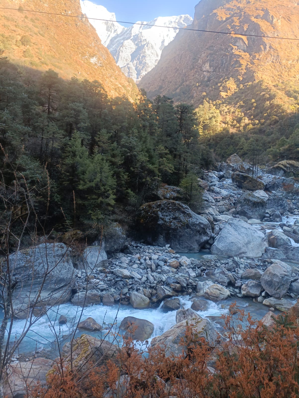
The trek from Simigaun to Dongang is a transformative journey that leads you away from the terraced hillsides and into the deep, primordial wilderness of the Rolwaling Valley. This segment is defined by a dense, atmospheric forest of rhododendron, bamboo, and pine, where the trail often winds through moss-covered terrain and follows the rugged contours of the Rolwaling Khola. As you navigate the steady ascents and occasional descents—rising from 2,020m to 2,790m—the landscape becomes increasingly wild and secluded, with the thunderous roar of the river and distant waterfalls providing a constant backdrop. Reaching Dongang, a small forest clearing with just a few lodges nestled by the riverbanks, offers a peaceful sense of isolation and serves as the perfect transition point before the valley opens up into the high-alpine landscapes of the upper Himalaya.
Max. Altitude
2,790mDuration
5–6 hrs.Distance: 10 –12 km | Time: 5–6 hrs. | Ascent: +930m
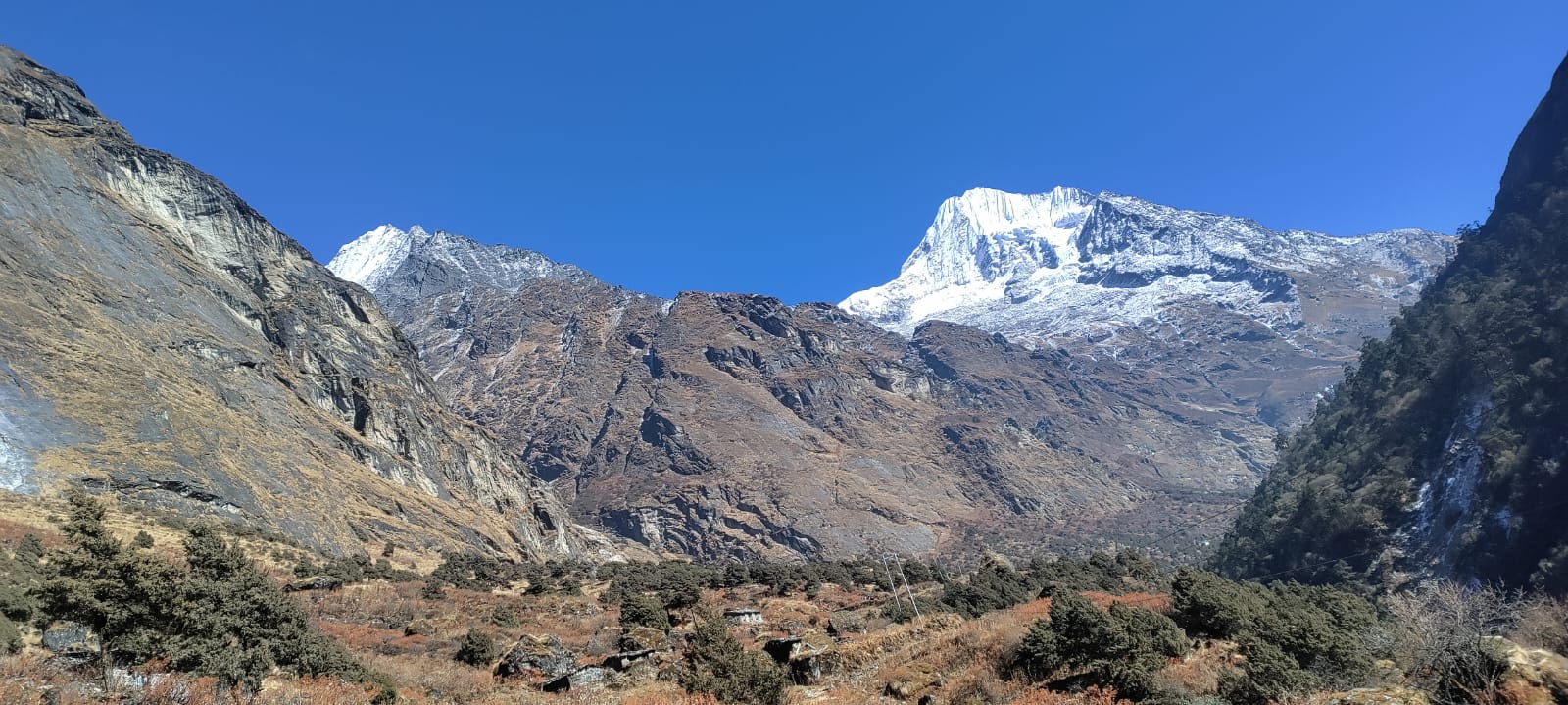
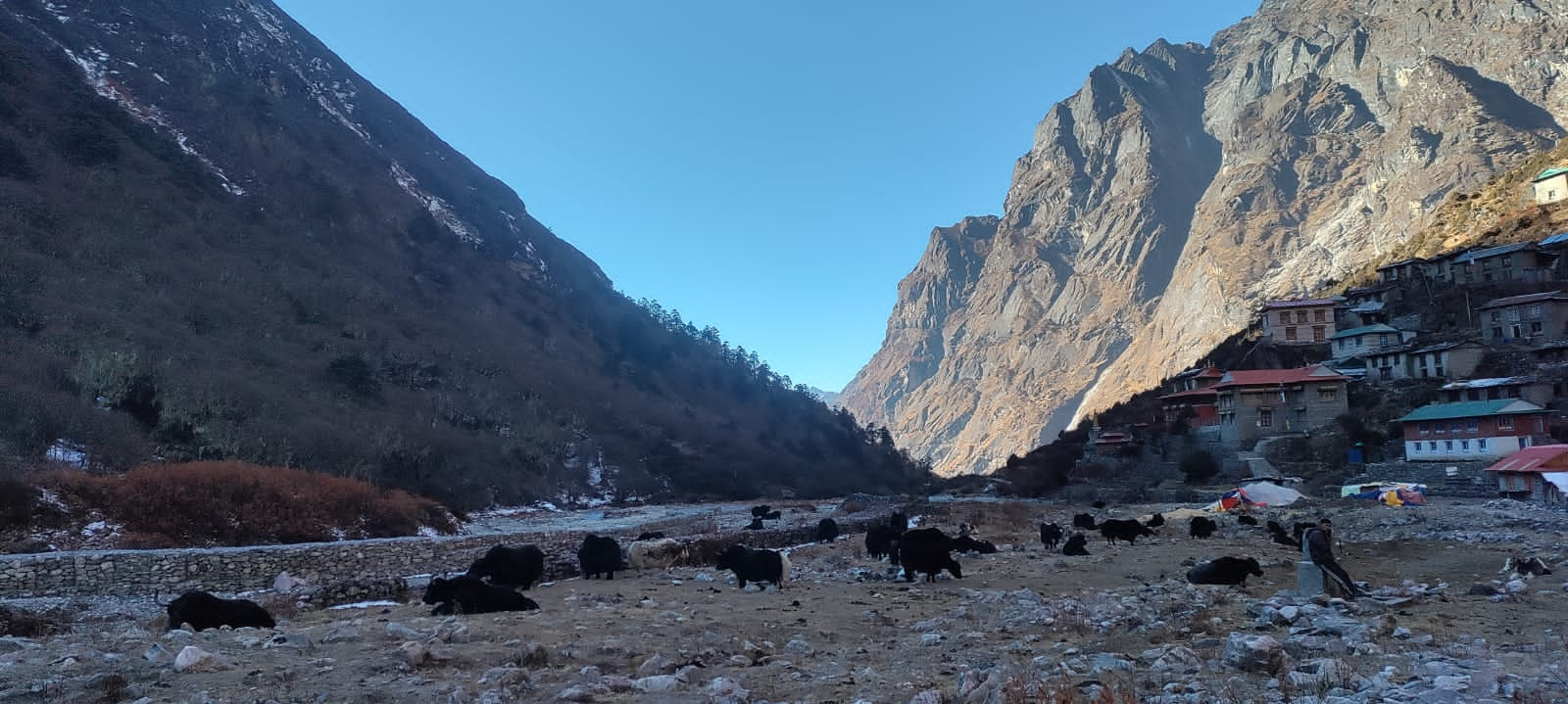
The trek from Dongang to Beding marks a dramatic transition as you leave the dense forest canopy and enter the wide, alpine heart of the Rolwaling Valley. Following the steady roar of the river, the trail climbs nearly 900 meters in elevation, moving from the lush greenery of 2,790m to the open, high-altitude landscape of 3,690m. As the rhododendrons and bamboo thin out, they are replaced by juniper shrubs and vast glacial vistas, eventually revealing the staggering, sacred north face of Gaurishankar (7,134m) looming above the valley. Arriving in Beding, the largest settlement in the region, you are greeted by a traditional stone-built Sherpa village where the air is crisp, the valley floor widens, and a sense of deep Himalayan spirituality prevails at the local ancient monastery.
Max. Altitude
3,720mDuration
5–6 hrs.Distance: 5 –6 km | Time: 3–4 hrs. | Ascent: +463m
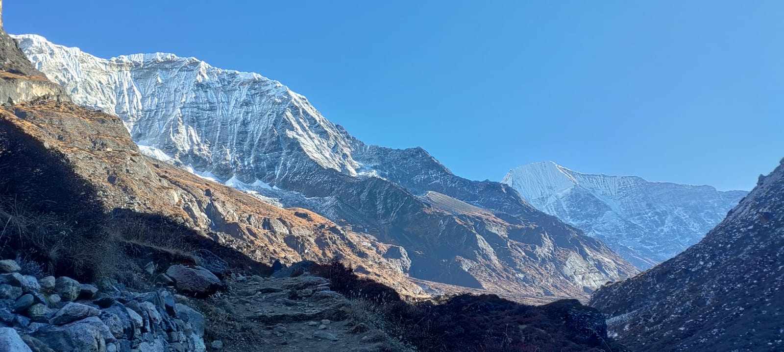
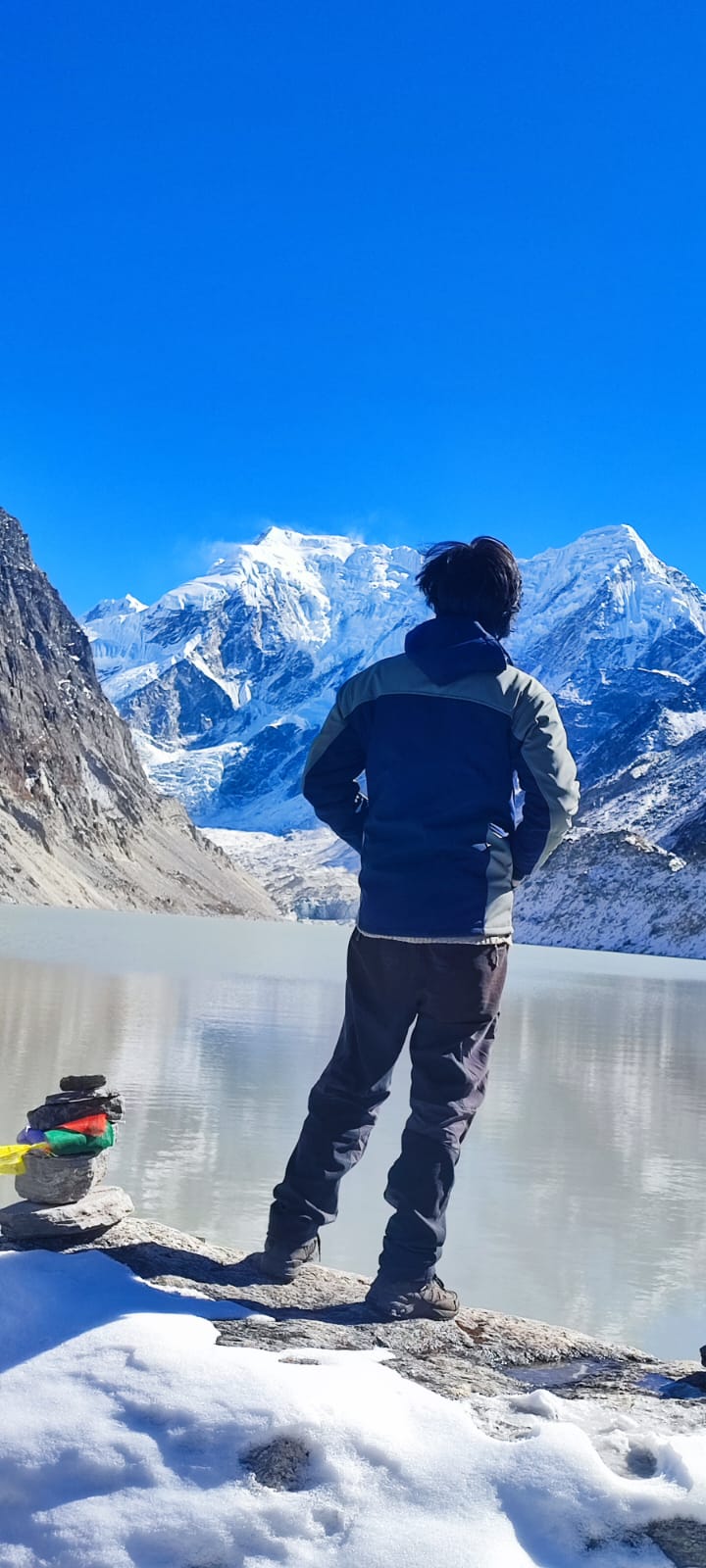
The trek from Beding to Na is a short but visually spectacular journey that leads you into the high-altitude heart of the upper Rolwaling Valley. Over the course of 3 to 4 hours, the trail follows a gentle upward gradient along the wide, U-shaped glacial valley floor. As you walk past ancient, long Mani walls and prayer flags, the landscape transitions into a high-alpine tundra dominated by low-lying shrubs and massive granite cliffs. The path offers intimate, front-row views of the towering Gaurishankar and the jagged peak of Chobutse, eventually opening up to the high summer pastures of Na. This small, stone-walled settlement serves as the final outpost of human habitation before the glaciers, providing a dramatic and windswept base for exploring the nearby Tsho Rolpa glacial lake.
Max. Altitude
4,183mDuration
3–4 hrs.Distance: 8 –10 km | Time: 6–7 hrs. | Ascent: +397m | Descent: -397m
The trek to Tsho Rolpa is a journey into a raw, glacial amphitheater where the silence is only broken by the occasional sound of shifting ice. From the pastures of Na, you ascend through a dramatic landscape of lateral moraines and gray riverbeds until the turquoise expanse of the lake reveals itself at 4,580m, cradled by the massive, ice-clad walls of the Trakarding Glacier. Standing at the edge of this vast alpine lake, you are surrounded by a theater of soaring peaks, including the impressive Bigphero Go Char, before making the swift and steady descent back to the relative warmth and thicker air of your lodge in Na.
Max. Altitude
4,580mDuration
6–7 hrs.Distance: 6 –8 km | Time: 5–6 hrs. | Ascent: +517m | Descent: -517m
The trek from Na to Dudh Kunda and back is a steep, spiritually significant excursion that leads you to the sacred “Milk Lake” tucked away at an altitude of 4,700m. Spanning a round-trip distance of approximately 6 to 8 kilometers, the journey involves a demanding climb north of the village, ascending through rugged alpine meadows and loose rocky scree at the base of the Yalung Ri glacier. Over the course of 5 to 6 hours, you are rewarded with a unique vantage point high above the valley floor, offering sweeping panoramas of the Gaurishankar and Chobutse massifs that are not visible from the main trail. After reaching the serene, milky waters of the lake—a site revered by local pilgrims—the descent follows the same steep path back to the pastures of Na, serving as an excellent final high-altitude challenge before beginning the journey back down the valley.
Max. Altitude
4,700mDuration
5–6 hrs.Distance: 15 –16 km | Time: 7–8 hrs. | Descent: -1,693m
The trek from Na to Dongang is a substantial but rewarding descent that transitions you from the stark, glacial beauty of the upper Rolwaling back into its lush, green heart. Spanning roughly 18 kilometers, the trail follows the Rolwaling Khola downstream, passing through the stone houses of Beding before plunging into the dense, oxygen-rich forests of pine and rhododendron. Over the course of 7 to 8 hours, you drop nearly 1,400 meters in elevation, leaving the high-alpine tundra behind for the humid, sheltered environment of Dongang, where the sound of the rushing river and the return of birdsong mark your return to the lower valley.
Max. Altitude
2,790mDuration
7–8 hrs.Distance: 13 –15 km | Time: 6–7 hrs. | Descent: -650m
The trek from Dongang to Tashinam is a beautiful transition from the wild, high-altitude forests back into the vibrant agricultural life of the Dolakha middle hills. Covering roughly 13 kilometers over 6 to 7 hours, the trail descends from the misty riverside camp of Dongang at 2,790m, retracing the path toward Simigaun before branching off to traverse the sun-drenched lower slopes. As you drop to an altitude of approximately 2,140m, the dense rhododendrons give way to terraced fields and small Sherpa settlements, offering a warmer climate and wide-angle views of the surrounding valleys. Arriving in Tashinam, a peaceful and sprawling village, marks a return to permanent community life, characterized by stone houses and a slower, traditional pace of mountain living.
Max. Altitude
2,140mDuration
6–7 hrs.Distance: 14 –16 km | Time: 6–7 hrs. | Descent: -990m
The trek from Tashinam to Jagat marks the final major transition of your journey, leading you out of the high Sherpa villages and down into the subtropical warmth of the Tamakoshi River valley. Covering a distance of approximately 15 kilometers over 6 to 7 hours, the trail involves a steady and significant descent from the hillsides of Tashinam at 2,140m to the riverside town of Jagat at roughly 1,150m. As you lose altitude, the rugged alpine scenery is replaced by lush greenery, cascading waterfalls, and vibrant terraces of rice and millet. The path winds through diverse ethnic settlements, offering a glimpse into the bustling rural life of the lower Dolakha district. Upon reaching Jagat, the crisp mountain air gives way to a humid, lively atmosphere, marking the conclusion of the trekking trails as you reconnect with the main road head for your return journey.
Max. Altitude
1,150mDuration
6–7 hrs.Distance: 170-180 km | Time: 5–6 hrs. | Ascent: +250m
The drive from Jagat to Kathmandu is a full-day journey that covers approximately 180 kilometers and takes between 5 and 6 hours. Leaving the lower Rolwaling region, you first navigate the winding roads alongside the Tamakoshi River before ascending to the district headquarters at Charikot. From there, the route follows the Jiri Road to join the Arniko Highway, descending toward the river confluence at Dolalghat before a final climb to the Kathmandu Valley rim at Dhulikhel. As you descend into the city, the humid riverside air gives way to the cooler atmosphere of the valley, marking the transition from the remote wilderness of Dolakha to the urban energy of the capital.
Max. Altitude
1,400mDuration
5–6 hrs.The departure from Kathmandu marks the final transition of your journey, moving from the vibrant, chaotic energy of the capital to the structured environment of Tribhuvan International Airport (TIA). For international flights, it is highly recommended to leave your hotel at least 3 to 4 hours before your scheduled departure, as Kathmandu’s traffic—particularly around areas like Thamel, Koteshwor, and Gaushala—can be unpredictable. After a final drive through the city’s bustling streets, you will arrive at the airport terminal where you must pass through initial security checks at the gate before proceeding to the check-in counters. Once you’ve completed immigration and final security, the departure lounge offers a last chance to reflect on your Rolwaling trek with a view of the surrounding hills, before finally boarding your flight and bidding farewell to the Himalayas.
Some important hints:
Clothing and accessories on trek
Other
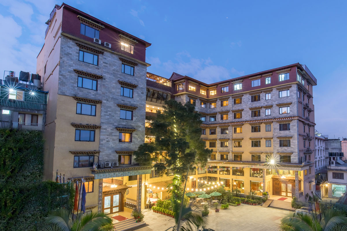
Hotel Tibet, a family-run boutique hotel that have blended traditional Tibetan designs with a touch of modern simplicity.
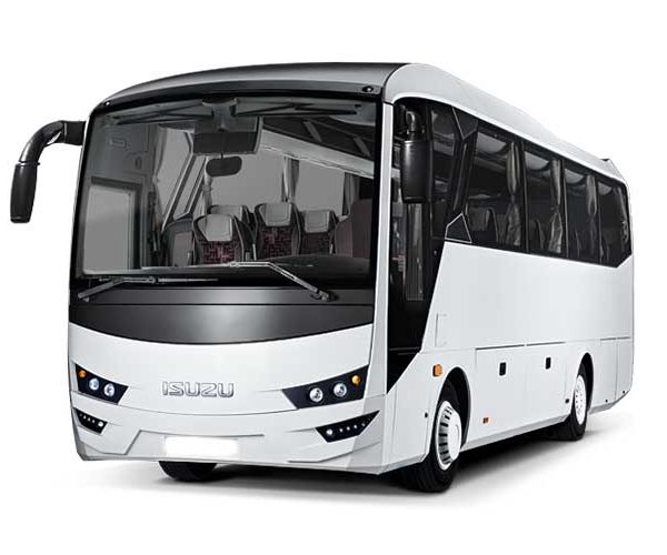
We provide professional Luxury Tourist Bus services designed for large groups, corporate retreats, and organized tours. Our fleet features modern, high-capacity buses equipped with comfortable reclining seats, full air conditioning, and wide windows for a premium sightseeing experience. With spacious under-carriage compartments for luggage and experienced drivers at the wheel, we ensure a safe, smooth, and relaxing journey on all major highways. Whether you are traveling across the city or across the country, our bus service offers the perfect blend of reliability, comfort, and affordability for your entire group.

Our Toyota Hiace service offers the perfect balance of speed, comfort, and flexibility for medium-sized groups and families. Known for its reliability and agility, the "Jumbo" Hiace provides a fast and efficient way to reach your destination, easily navigating both smooth highways and narrower mountain roads. With a high-roof design for extra headroom, air-conditioned interiors, and a private "door-to-door" service, we ensure a premium travel experience that gets you there ahead of the crowd.

Our Mahindra Scorpio 4WD service offers the ultimate combination of power, durability, and rugged luxury for explorers and small groups. Engineered to conquer the demanding terrain of the Himalayas, the Scorpio provides a robust and dependable way to navigate steep inclines, unpaved tracks, and challenging weather conditions. With its high ground clearance, heavy-duty suspension, and powerful 4x4 capabilities, our private "door-to-trailhead" service ensures you reach your destination safely and comfortably, no matter how remote. Featuring an ergonomic cabin, climate control, and ample space for expedition gear, we deliver a high-performance travel experience designed to get you deep into the heart of the mountains where others cannot follow.

WhatsApp +9779841603796
From Everest Base Camp to hidden valleys of Mustang, let us design a journey that’s truly yours.
Start Planning My Trip